Tel Code..: +226
Ethopian Airlines - Air France- Lufthansa- Royal Air Maroc- THY
Viza..: Needs
Courses or boosters usually advised: Hepatitis A; Poliomyelitis; Tetanus; Typhoid; Yellow Fever.
Other vaccines to consider: Cholera; Diphtheria; Hepatitis B; Meningococcal Meningitis; Rabies.
Yellow fever vaccination certificate required for travellers over 1 year of age arriving from countries with risk of yellow fever transmission.
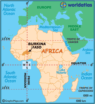
Name: Burkina Faso
President: Blaise Compaoré (1987)
Prime Minister: Luc-Adolphe Tiao (2011)
Land area: 105,714 sq mi (273,799 sq km); total area: 105,869 sq mi (274,200 sq km)
Population (2012 est.): 17,275,115 (growth rate: 3.07%); birth rate: 43.2/1000; infant mortality rate: 79.84/1000; life expectancy: 54.07; density per sq km: 53
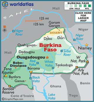
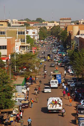
Capital and largest city (2009 est.): Ouagadougou, 1,777,000
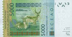
Monetary unit: CFA Franc
Burkina Faso, once known as Upper Volta, and as the longtime kingdom of the
Mossi people, was first populated between 14,000 and 5,000 BC by hunter-gatherers.
 Between the 10th and
11th centuries, Mossi tribes immigrated into the region from Ghana,
pushing out the original Yonyonse inhabitants, and began creating complex states
complete with powerful militaries.
Between the 10th and
11th centuries, Mossi tribes immigrated into the region from Ghana,
pushing out the original Yonyonse inhabitants, and began creating complex states
complete with powerful militaries.
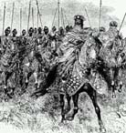
There were a number of Mossi kingdoms within Burkina Faso, the most significant
being the Wagadogo (Ouagadougou) and Yatenga, and they survived until the late
19th century.
Following a decade of intense rivalry and competition with Britain and France,
the Mossi's were defeated by French forces, and subsequently colonized in 1896.
In 1958, the region achieved self-governance, becoming the Republic of Upper
Volta, and by 1960 had gained complete independence from France.
Subsequently, the Upper Volta suffered from numerous military coups in its early
days as a new nation. In 1983 Thomas Sankara, a Burkinabe military captain,
Marxist revolutionary and Pan-Africanist theorist, seized power, and became
president.
Sankara changed the name of Upper Volta to Burkina Faso, meaning "the country of
honorable people" on August 4, 1984; he was a widely regarded and charismatic
leader whose revolutionary programs forAfrican self-reliance
made him an icon to Africa's poor.
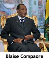 In 1987 a French-backed
coup overthrew and then assassinated Sankara as a result of his revolutionary
ideals, and Captain Blaise Compaore came into power.
In 1987 a French-backed
coup overthrew and then assassinated Sankara as a result of his revolutionary
ideals, and Captain Blaise Compaore came into power.
Dissatisfied with the progression of the country, a new constitution was drafted
in 1991, and countrywide elections held the following year - the results of
which helped form a stable coalition government.
With a high population density and very limited natural resources, most of the
citizens remain economically suppressed. Local health conditions are improving,
but still generally poor in the rural areas. The country is reported to have the
second-highest illiteracy rate on the planet.
The death of a schoolboy in early 2011 sparked a country-wide uprising, complete
with military mutiny, lasting some two months before they were subdued by a
consideration to change the constitution.
Located
on the southern fringes of the Sahara Desert, Burkina Faso is mostly a wide,
flat plain with hillier land in the west and far southeast.
Southwest, a sandstone massif covers much of the land, and it is here that the
highest point of the country is found: Tena Kouron at 2,451 ft. (747 m). The
lowest point of the country is the Mouhoun (Black Volta) River at 656 ft. (200
m).
The Black, Red and White Voltas are the major rivers, and all flow south into Ghana.
Out of all the rivers in Burkina Faso, the Black Volta is one of two that flows
year-round, with the second being the Komoe. The Niger River basin drains 27% of
the surface of the country.
In addition to the rivers, Burkina Faso contains numerous lakes and large ponds;
even still, water shortages are a consistent problem, especially in the north as
most sources are seasonal.
Climate:
Conditions in Burkina Faso are tropical, and normally sunny, warm and quite dry.
High temperatures during the dry season (March
through May)
exceed 100°F (37°C) on a regular basis.
The rainy season runs June through October, and annual rainfall is heaviest in
the south (approximately
40 inches),
while in the north and northeast, 10 inches annually is the norm.
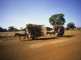
Burkina Faso is one of the poorest nations in the world, with few natural resources; the great majority of its workers engage in subsistence farming. Less than 10% of the country's land area is cultivable without irrigation, and droughts have further limited agricultural production; however, several dams intended for irrigation and hydroelectricity, including the Ziga dam on the Nakambe River, which supplies the capital, were constructed in the 1990s. The principal cash crop is cotton; other agricultural commodities include peanuts, shea nuts, sesame, sorghum, millet, corn, and rice. Cattle, sheep, and goats are raised.
The country's industry is limited largely to the production of cotton lint, foodstuffs, and basic consumer goods. Burkina Faso has a small mining industry that produces manganese, phosphates, and gold-bearing quartz; other small mineral deposits remain untapped. The country has a comparatively good road network. A railroad runs from Ouagadougou to the seaport of Abidjan, Côte d'Ivoire, via Bobo-Dioulasso and Banfora; it is currently being extended NE to Tambao.
The annual cost of Burkina Faso's imports is usually much higher than its earnings from exports, and the nation relies on debt servicing from other countries. The principal imports are capital goods, foodstuffs, and petroleum; the leading exports are cotton, live animals, and gold. The chief trading partners are China, France, Côte d'Ivoire, and Singapore. Large numbers of the male labor force migrate to Côte d'Ivoire and (to a lesser extent) Ghana for seasonal work, but their labor contributes little to the national economy.
Burkina Faso is a parliamentary republic governed under the constitution of 1991, as amended. The executive branch is headed by a president, who is elected by popular vote for a five-year term and is eligible for a second term. The prime minister, who is the head of government, is appointed by the president. The unicameral legislature consists of a 111-member National Assembly, whose members are popularly elected to serve five-year terms. Administratively, the country is divided into 45 provinces.
The country is made up mainly of vast monotonous plains and of low hills that rise to c.2,300 ft (700 m) in the southwest. Precipitation is low (nowhere exceeding 45 in./114 cm annually), and the soil is of poor quality. Rainfall is heaviest in the southwest, which is covered largely with savanna; the rest of the country is semidesert. Burkina Faso has several unnavigable rivers. In the southwest is the Komoé (Comoé) River, which flows through Côte d'Ivoire to the Gulf of Guinea; in the center are the Mouhon (Black Volta), Nazinon, and Nakambe (White Volta) rivers, which join in Ghana to form the Volta; and in the northeast are several small tributaries of the Niger.
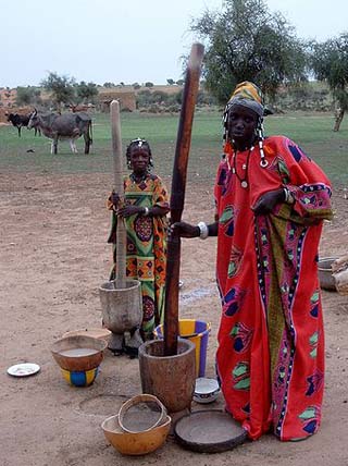
The majority of Burkina Faso's population live in rural areas. Of some 50 ethnic groups, the principal group is the Mossi, who account for almost half of the total population; others include the Lobi, Bobo, and Gurunsi, all of whose members speak a Voltaic language; Fulani, Mande, and Senufo also constitute sizable minorities. French is the country's official language, and Oyula is spoken in commercial circles. Muslims account for 50% of the population, while 40% follow traditional beliefs and approximately 10% are Roman Catholics.