


Tel Code..: +237
Ethopian Airlines - Air France- Lufthansa- Royal Air Maroc- THY-KLM
Viza..: Needs
Courses or boosters usually advised: Hepatitis A; Poliomyelitis; Tetanus; Typhoid; Yellow Fever.
Other vaccines to consider: Cholera; Diphtheria; Hepatitis B; Meningococcal Meningitis; Rabies.
Yellow fever vaccination certificate required for travellers over 1 year of age arriving from countries with risk of yellow fever transmission.
Name: Cameroon
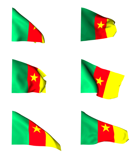
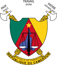
Republic of Cameroon
President: Paul Biya (1982)
Prime Minister: Ephraïm Inoni (2004)
Land area: 181,251 sq mi (469,440 sq km); total area: 183,567 sq mi (475,440 sq km)
Population (2012 est.): 20,129,878 (growth rate: 2.08%); birth rate: 32.49/1000; infant mortality rate: 59.7/1000; life expectancy: 54.71; density per sq km: 39
Capital (2009): Yaoundé, 1,739,000
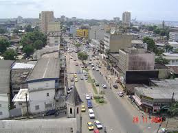
Largest city: Douala, 2,053,000
Monetary unit: CFA Franc
Read more: Cameroon:
Maps, History, Geography, Government, Culture, Facts, Guide & Travel/Holidays/Cities
| Infoplease.com http://www.infoplease.com/country/cameroon.html#ixzz38acALWxs
First inhabited by the mysterious Pygmies, and then the Bantu and Sudanic
peoples, Cameroon would eventually become an infamous source of slaves for
Muslim andEuropean traders.
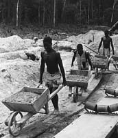
Missionaries arrived in the mid-19th century, and the land was subsequently
colonized by Germany who
set their sights on improving the colony's foundation - albeit with a harsh
system of forced labor.
In the early 1900's (during World War I), it was invaded by both Britain and France,
and later divided between the two countries.
 French Cameroun,
as it was called, integrated their culture with the present economy, and
advanced the country's infrastructure in much of the same way as theGermans had
done previously; however,Britain governed
their portion from Nigeria,
which caused natives to feel neglected.
Cameroon first flirted with independence in 1960, but then a long series of
internal political juggling between north and south, and the bloody coups of the
1980s delayed that process until the 1990s.
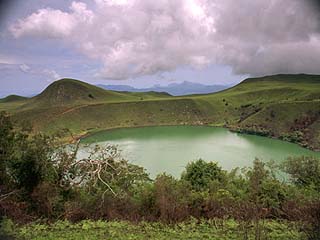
Amidst the political turmoil, a natural disaster occurred on August 15, 1984, as
Lake Monoun exploded in a limnic eruption, and released carbon dioxide into the
air. A larger eruption at Lake Nyos in 1986 killed upwards of 1,800 citizens and
3,500 livestock; both disasters are the only two ever recorded of their kind.
Presently, Cameroon still struggles to achieve peace within its boundaries, and
unrest amongst its citizens continues to persist.
A union strike in Douala in February 2008 culminated into violent protests,
becoming the worst act of violence the country had seen in 15 years - in spite
of the incessant tension mounting over decades past.
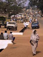 Cameroon is
ethnically diverse with over 225 individual groups. The local economy is driven
by foreign aid, a wide variety of agricultural ventures and oil and timber
production.
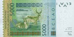
Tourism is limited, but those who venture here enjoy the beach areas near Kribi,
the interesting capital city of Yaoundé, and the abundant wildlife of the
national parks, especially the elephants found in Waza National Park.
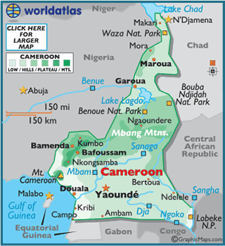
From the low and marshy coastal area, the land of Cameroon rises into a rain
forest plateau.
From there the land moves higher into the central Adamawa Plateau, where some
elevations reach over 4,000 ft.
To the north of Benoue National Park, the land slopes into a savanna plain that
extends to the shores of Lake Chad.
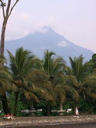
In the far southwest Cameroon is mountainous. Mt Cameroon (an
active volcano),
sits on the edge of the Gulf of Guinea, and is the highest point in West Africa,
as well as in Cameroon, at 13,353 ft. (4,070 m).
Significant rivers include the Dja, Nyong and Sanaga. Cameroon's lowest point is
the Atlantic
Ocean (0
m).
Climate:
The tropical coastal areas of Cameroon receive copious amounts of rain, in some
years the rain has exceeded 30 feet (9 m). In the northern areas, yearly
precipitation amounts are much lower, averaging near 30 inches (762 mm). Drought
is a way of life in the far north.
Daily highs in the mid-80's (29°C) are commonplace, and overall, mean
temperatures average in the high 70's (20°C); slightly warmer in the south, and
a bit cooler in the western mountains.
Offshore oil deposits exploited since the early 1970s have made Cameroon one of the most prosperous nations in tropical Africa. Oil refining and the production of crude oil products lead the nation's industries. Before the advent of the petroleum business, agriculture was the country's economic mainstay, and it still contributes about 45% of the country's gross domestic product and employs about 70% of the people. The north, where cattle raising is the chief occupation, is the least economically developed part of Cameroon, whose regional disparities pose a major problem for the government.
Cameroon is one of the world's leading cocoa producers; coffee, rubber, bananas, palm products, and tobacco, all grown mainly on plantations, are also commercially important. The principal subsistence crops are bananas, cassava, yams, plantains, peanuts, millet, and sorghum.In spite of this diverse agricultural production, only a small percentage of the country's land is cultivated, but food production in Cameroon meets domestic demand despite the occurrence of periodic droughts.
Fishing and forestry follow oil and agriculture as leading occupations. Cameroon's mineral resources include bauxite and iron ore. The Edéa Dam on the Sanaga River provides the bulk of the country's electricity and powers a large aluminum smelter; finished aluminum is exported. Food processing, sawmilling, and the manufacture of light consumer goods and textiles are important industries.
Cameroon's exports include crude oil and petroleum products, lumber, cocoa beans, aluminum, coffee, and cotton. France, Spain, Italy, and Nigeria are the major trading partners. The country is a member of the Commonwealth of Nations.
Government
Cameroon is governed under the constitution of 1972 as amended. The president, who is head of state, is popularly elected for a seven-year term; there are no term limits. The government is headed by the prime minister, who is appointed by the president. The bicameral legislature consists of the 180-seat National Assembly and 100-seat Senate; members of both serve five-year terms. The Assembly is elected by popular vote. Seven senators are elected from each region by the region's municipal councilors, and the rest are appointed by the president. Administratively, the country is divided into 10 regions.
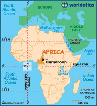
Cameroon is triangular in shape. A coastal strip 10 to 50 mi (16–80 km) wide in the southwest is covered with swamps and dense tropical rain forests; it has one of the wettest climates in the world, with an average annual rainfall of 152 in. (386 cm) on the coast. Near the coast are volcanic peaks, dominated by Mt. Cameroon (13,354 ft/4,070 m), the highest point in the country. Beyond the coastal marshes and plains, the land rises to a densely forested plateau c.1,000 ft (300 m) above sea level. The interior of the country is a plateau c.2,500 to 4,000 ft (760–1,220 m) high, where forests give way to savanna. This plateau forms a barrier between the agricultural south and the pastoral north. The extreme northern regions, near Lake Chad, are dry thornbush lands. Among the many rivers that drain Cameroon are the Bénoué, the Wuori, the Sanaga, and the Nyong.
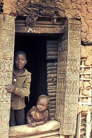
The country consists of the former French Cameroons and the southern portion of the former British Cameroons. The French, or eastern, section constitutes four fifths of the country and supports the bulk of the population. With more than 200 ethnic groups, Cameroon has one of the most diverse populations in Africa. Bantu-speaking peoples, such as the Douala, predominate along the southern coast and in the forested areas. In the highlands are the Bamiléké. Important northern groups include the Fulani and the Kirdi. French and English are the official languages, but there are also 24 major African language groups in the country. About 40% of the people follow traditional beliefs, while another 40% are Christian and about 20% are Muslim; Islam is the dominant religion of the northern regions.