Tel Code..: +240
Air France- Lufthansa- Royal Air Maroc- Iberia
Viza..: Needs
Courses or boosters usually advised: Hepatitis A; Poliomyelitis; Tetanus; Typhoid; Yellow Fever.
Other vaccines to consider: Cholera; Diphtheria; Hepatitis B; Meningococcal Meningitis; Rabies.
Yellow fever vaccination certificate required for travellers over 1 year of age arriving from countries with risk of yellow fever transmission.
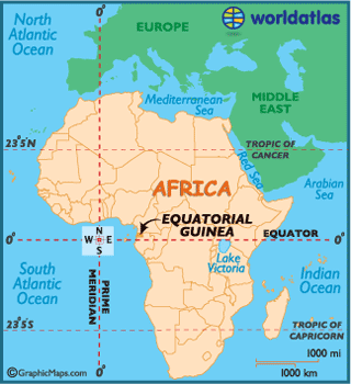
Name: Equatorial Guinea
President: Col. Teodoro Obiang Nguema Mbasogo (1979)
Prime Minister: Vicente Ehate Tomi (2012)
Total area: 10,830 sq mi (28,050 sq km)
Population (2012 est.): 685,991 (growth rate: 2.61%); birth rate: 34.88/1000; infant mortality rate: 75.18/1000; life expectancy: 62.75; density per sq km: 20
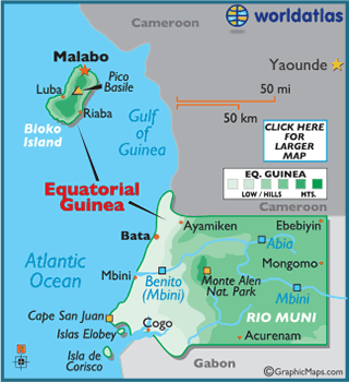
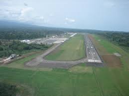
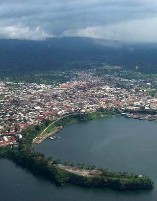
Capital and largest city (2009 est.): Malabo, 128,000
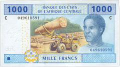
Monetary unit: CFA Franc
Read more: Equatorial
Guinea: Maps, History, Geography, Government, Culture, Facts, Guide & Travel/Holidays/Cities
| Infoplease.com http://www.infoplease.com/country/equatorial-guinea.html#ixzz38aTn6dIg
Equatorial Guinea is believed to have first been inhabited by Pygmies, and it
wasn't until the late 15th century when the island now called Bioko was first
discovered by Portuguese explorers.
Originally named for the explorer Fernando Poo, Bioko, was ceded to the Spanish in
1778. Then in 1827, theBritish founded
Malabo and maintained a naval station there in an effort to squelch the slave
trade along theAfrican coast.
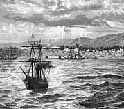 Upon their arrival in
1858, Spanish settlers
began colonizing Bioko and the mainland. It was called Spanish Guinea until the
5 islands (two quite small), as well as the mainland territory of Rio Muni,
became Equatorial Guinea in 1968, after gaining independence fromSpain.
Upon their arrival in
1858, Spanish settlers
began colonizing Bioko and the mainland. It was called Spanish Guinea until the
5 islands (two quite small), as well as the mainland territory of Rio Muni,
became Equatorial Guinea in 1968, after gaining independence fromSpain.
Francisco Macias Nguema became the country's first president, and under his
reported "reign of terror" a third of Equatorial Guinea's population were
sentenced either to exile or death. Subsequently, the economy collapsed, and a
bloody coup was waged against Nguema in 1979 by Teodoro Obiang.
Obiang assumed office following the coup, and set to work on restoring order to
the devastated country.
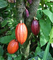 Long dependent on
cocoa production for cash flow, as well as farming, fishing and forestry
products, the recent discovery and subsequent selling of large oil reserves has
certainly improved the local economy, at least for government officials,
families and friends.
Long dependent on
cocoa production for cash flow, as well as farming, fishing and forestry
products, the recent discovery and subsequent selling of large oil reserves has
certainly improved the local economy, at least for government officials,
families and friends.
It was those internal relationships that became the major catalyst for both the
World Bank and International Monetary Fund (IMF) to cancel their long term and
much-needed financial aid agreements to this very poor country.
Regardless, the future in Equatorial Guinea is uncertain, as much of the
infrastructure (especially on the mainland) needs attention, health care must
improve, and like many African countries,
its literacy level is extremely low.
The mainland of Equatorial Guinea begins on a narrow coastal plain, edged by
mangrove swamps.
From there, the land rises into an elevated plateau of thickly forested hills to
its border with Gabon,
reaching (in
a few places)
upwards of 4,000 ft. (1,219 m) above sea level.
The major river, the Uola, snakes its way across the center of the country.
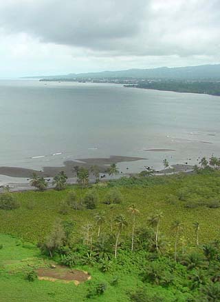
The offshore island of Bioko, volcanic in origin and very fertile, is dominated
by three extinct volcanoes. Its coastline is steep and rugged south, but there
are scenic beaches and harbors along the northern coast.
The highest point of Equatorial Guinea is Pico Basile at 8,868 ft (3,008 m); the
lowest point of the country is the Atlantic Ocean (0 m).
Climate:
Equatorial Guinea, just a few degrees north of theEquator,
has a consistent tropical climate, one that's hot and humid throughout the year.
The mean high temperature approaches the lows 80°F (26°C).
The rainy season runs from April to October, and 10 inches (25 cm) per month are
commonplace.
Subsistence farming is the predominant occupation in Equatorial Guinea, although only 5% of the land is arable. Prior to independence, the money economy was based on the production of cocoa (mostly on Bioko) and coffee and timber (in Río Muni). Following severe deterioration of the rural economy, the government has made efforts to increase production of these products to preindependence levels. Other agricultural products include rice, yams, cassava, bananas, and palm oil. Livestock are raised and there is a fishing industry. There is food processing, sawmilling, and the manufacture of basic consumer items. The discovery and exploitation of large offshore oil and natural gas deposits increased economic growth beginning in the late 1990s, but the oil and gas revenue, largely lost to government corruption, has not significantly improved the standard of living in the generally improverished nation. The country also has unexploited deposits of titanium, iron ore, manganese, uranium, and gold. Both Río Muni and Bioko have substantial road networks; there are no railroads. Malabo is the main port.
The value of Equatorial Guinea's exports is considerably higher than the cost of its imports. The United States is the country's largest trading partner, followed by China, Spain, Italy, and France. The main exports are petroleum, methanol, timber, and cocoa; the chief imports are petroleum equpment and other machinery, foodstuffs, and beverages. Equatorial Guinea continues to depend heavily on foreign investment.
Equatorial Guinea is governed under the constitution of 1991 as amended. The president, who is head of state, is popularly elected for a seven-year term; a two-term limit was adopted in 2011. The government is headed by a prime minister, who is appointed by the president. The bicameral legislature consists of the 100-seat House of People's Representatives, whose members are elected to serve five-year terms. The Senate (first elected in 2013) has 70 members, 55 of whom are elected; the rest are appointed by the president. Members of the legislature are elected from multimember constituencies on a proportional basis. The legislature has little power, as the constitution vests most authority in the president. Administratively, the country is divided into seven provinces.
Land and People
Río Muni, located just north of the equator, is made up of lowland along the coast, which gradually rises in the interior to c.3,600 ft (1,100 m). Río Muni includes three major rivers—the Campo, which forms part of the northern boundary; the Benito, located in the center; and the Muni, which forms part of the southern boundary. There are forests of okume, mahogany, and walnut along the coast and the rivers. Bioko is made up of three extinct volcanoes, the loftiest of which is c.9,870 ft (3,010 m) high. The island has abundant fertile volcanic soil. Corisco and the Elobey islands are located near the the Muni estuary.
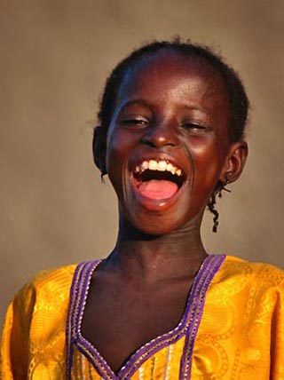
Most of the people in Equatorial Guinea belong to the Bantu ethnolinguistic group. The main ethnic group in Río Muni, where most of the population lives, is the Fang. The population of Bioko is primarily made up of the Bubi (the oldest of the modern-day inhabitants), descendants of slaves from W Africa liberated by the British in the 19th cent., and Nigerians and Fangs who migrated there in the 20th cent. Spanish and French are the official languages, but Fang, Bubi, and other indigenous languages are widely spoken. The population is nominally Christian and predominantly Roman Catholic; some indigenous religions are practiced.