Tel Code..: +223
Ethopian Airlines - Air France- Air Royal Maroc- Air Algeria - KLM
Viza..: Needs
Courses or boosters usually advised: Hepatitis A; Poliomyelitis; Tetanus; Typhoid; Yellow Fever.
Other vaccines to consider: Cholera; Diphtheria; Hepatitis B; Meningococcal Meningitis; Rabies.
Yellow fever vaccination certificate required for travellers over 1 year of age arriving from countries with risk of yellow fever transmission.
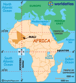
Name: Mali
President: Ibrahim Boubacar Keita (2013)
Prime Minister: Moussa Mara (2014)
Land area: 471,042 sq mi (1,219,999 sq km); total area: 478,767 sq mi (1,240,000 sq km)
Population (2013 est.): 15,968,882 (growth rate: 3.01%); birth rate: 46.06/1000; infant mortality rate: 106.49/1000; life expectancy: 54.55
Capital and largest city (2009 est.): Bamako, 1.628 million
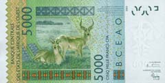
Monetary unit: CFA Franc
Mali, a landlocked country in West Africa, was once a part of three prominent
empires: the Ghana Empire, Mali Empire, and Songhay Empire.
It's early history is marked by strong leadership and kin-based societies that
lacked structured geographical boundaries.
The Ghana Empire was the earliest known in the region, and was dominated by
Mande-speaking peoples. From the 8th century through the end of the 11th century
they expanded throughout West Africa, and controlled the trans-Saharan gold and
salt trade centers.
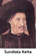 Sundiata Keita founded
the Mali Empire on the upper Niger River in the year 1230. The empire consisted
of various kingdoms and provinces, extending over a vast area of land, and
reached the height of its power during the 14th century.
Sundiata Keita founded
the Mali Empire on the upper Niger River in the year 1230. The empire consisted
of various kingdoms and provinces, extending over a vast area of land, and
reached the height of its power during the 14th century.
Internal unrest ultimately resulted in the downfall of the Mali Empire, and in
the late 14th century the Songhais assumed the entire eastern portion of the
fallen Mali Empire.
After Morocco brutally invaded the Songhais in 1591, the empire collapsed, and
the entire region lost its role as a trading crossroad.
In the 1800's, Mali was part of the French Sudan; then, along with Senegal, Mali
gained independence in 1959 and became the Mali Federation. In 1960, the Mali
Federation became the nation of Mali.
The first president, Modibo Keita, established a one-party system and
implemented nationalization of Mali's economic resources.
The Keita regime was overthrown by a military coup, led by Moussa Traore, in
November of 1968. Traore attempted to reform the economy, but was hampered by
the political turmoil and a devastating drought which killed thousands.
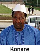 A coup in 1991 brought
a more transitional government and the writing of a new constitution. Alpha
Oumar Konare won the first multi-party democratic presidential election, and was
in office until 2002, when he was succeeded by reited general Amadou Toumani
Toure.
A coup in 1991 brought
a more transitional government and the writing of a new constitution. Alpha
Oumar Konare won the first multi-party democratic presidential election, and was
in office until 2002, when he was succeeded by reited general Amadou Toumani
Toure.
Mali was widely regarded as a politically and socially stable country during
this democratic period, however, in January 2012 the National Movement for the
Liberation of Azawad staged an insurgency against the government.
The northern part of the country has since been left to MNLA rebels, while the
government controls only the southern part.
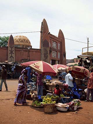
Mali today is one of the poorest countries in the world. The average worker's
annual salary is around U.S. $1,500.
The key industry is agriculture, with cotton as its largest crop export followed
by gold and livestock.
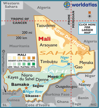
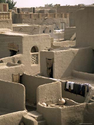
Mali's landscape is mostly a savanna grassland that rolls into higher plateaus
as you move north. Rugged hills with elevations that reach upwards of 3,280 ft
(1,000 m) dot the northeast.
Approximately 65% of the country is covered by desert or semi-desert.
The lowest point of the country is the Senegal River at 75 ft (23 m); the
highest point of Mali is Hombori Tondo at 3,789 ft (1,155 m).
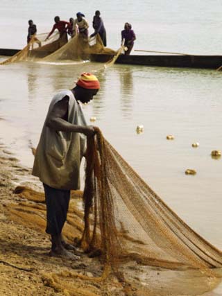
The largest rivers in Mali are the Niger and Senegal. Considered to be Mali's
lifeblood (its source of food, drinking water, irrigation and transportation)
the Niger River snakes through roughly 2,600 miles (4,180 km) of western Africa.
Climate:
Mali remains relatively dry, with a climate that varies from subtropical to arid
as you move north.
The cool, dry season runs November through February, with the rainy season
lasting from June through September.
Beginning in October, the Harmattan trade wind blows sand, grit and dry air
across the country. The hottest time of the year is March through June.
The vast majority of Malians are employed in farming, herding, or fishing. Cotton and peanuts are the country's only significant cash crops, with millet, rice, corn, sorghum, and vegetables being the major food crops. Agriculture and herding have been increasingly hurt by the encroaching desert. Mali's industries are mainly limited to the processing of farm commodities, construction, and the manufacture of basic consumer goods. Gold, phosphate, kaolin, salt, limestone, and uranium are mined, and the country has extensive unexploited mineral resources, including bauxite, iron ore, manganese, tin, and copper. Remittances from Malians working abroad are also an important source of income. The Manantali Dam on the Bafing River (a Senegal tributary) produces hydroelectric power.
Gold and cotton account for the bulk of Mali's export revenues; livestock and fish are also exported. The main imports are petroleum, machinery and equipment, construction materials, food, and textiles. Mali's chief trading partners are China, France, Senegal, and Thailand.
Mali is governed under the constitution of 1992. The executive branch is headed by a president, who is the head of state and is popularly elected for a five-year term and is eligible for a second term. The prime minister, who is the head of government, is appointed by the president. The unicameral National Assembly has 147 members who are popularly elected for five-year terms. Administratively, the country is divided into eight regions.
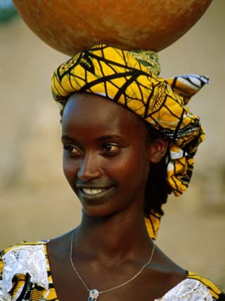
In the south, traversed by the Niger and Senegal rivers, are fertile areas where cotton, rice, and peanuts are grown. Elsewhere the country is arid desert or semidesert and barely supports grazing (mainly cattle, sheep, and goats). The Niger serves as an important transportation artery and a source of fish. The main ethnic groups are the Mande (Bambara, Malinke, and Soninke), who are chiefly farmers and fishermen, and the Fulani and Tuareg, who are pastoralists. About 90% of the population is Muslim; most of the remainder follow traditional religions. While French is the official language, Bambara is spoken by 80% of the population and there are many other African tongues.