

Tel Code..: +227
Ethopian Airlines - Air France- Royal Air Maroc- THY
Viza..: Needs
Courses or boosters usually advised: Hepatitis A; Poliomyelitis; Tetanus; Typhoid; Yellow Fever.
Other vaccines to consider: Cholera; Diphtheria; Hepatitis B; Meningococcal Meningitis; Rabies.
Yellow fever vaccination certificate required for travellers over 1 year of age arriving from countries with risk of yellow fever transmission.
Name: Niger
President: Mahamadou Issoufou (2011)
Prime Minister: Brigi Rafini (2011)
Land area: 489,072 sq mi (1,266,699 sq km); total area: 489,189 sq mi (1,267,000 sq km)
Population (2010 est.): 15,878,271 (growth rate: 3.6%); birth rate: 51.1/1000; infant mortality rate: 114.5/1000; life expectancy: 52.9; density per sq km: 10
Capital and largest city (2003 est.): Niamey, 748,600
Other large cities: Zinder, 202,300; Maradi, 189,000
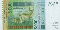
Monetary unit: CFA Franc
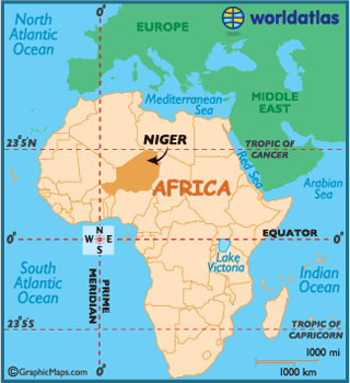
Officially the Republic of Niger, this landlocked country ofWestern
Africa is
nearly completely covered by the Saharan desert.
Little is known of Niger's pre-history, although humans have lived in the region
for nearly 2-3.5 million years.
Niger's history begins with the expansion of the Songhai Empire in the 15th
century.
Following their decline the Mali, Dendi, Gao, Kanem-Bornu, and Hausa empires
claimed key areas of Niger until contact with Europeans began
during the 19th century.
 The first Europeanexplorers
arrived in search of the source of the Niger River, and by 1922 Niger had become
aFrench Colony.
The country gained independence fromFrance in
1960 and experienced single-party and military rule under Niger's first
president, Hamani Diori. Although Diori was highly respected internationally for
being a spokesman on African affairs, within Niger his administration was
completely corrupt.
Widespread disorder plagued Niger until a military coup led by Seyni Kountche
ended Diori's rule in 1974. Following his arrest the country fell into disarray
until 1991, when Ali Saibou (Niger's third president) was forced by public
pressure to allow multiparty elections, that ultimately resulted in a democratic
government in 1993.
Political infighting brought the government to a standstill and in 1996, led to
a coup by Col. Ibrahim Baré Maïnassara.
 In 1999, Ibrahim Baré
Maïnassara was killed in a coup by military officers who promptly restored
democratic rule and held elections that brought Mamadou Tandja to power in
December of that year. Tandja was reelected in 2004.
In February, 2010 a military junta was established, following a coup d'état
which deposed Tandja. The country is led now by the Supreme Council for the
Restoration of Democracy (CSRD).
Niger is one of the poorest countries in the world with minimal government
services and insufficient funds to develop its resource base. The largely
agrarian and subsistence-based economy is frequently disrupted by extended
droughts common to the Sahel region ofAfrica.
The sub-Saharan landscape of Niger is characterized by deserts, sand dunes,
uplands and hills, as both the Sahel and Saraha Deserts dominate the region.
In the lower part of the country 2% of the land is covered with forests and
woodlands.
The third longest river in Africa,
the Niger River, runs in a crescent from the Guinea Highlands through Mali,
and makes up part of the Benin-Niger
border. It is Niger's lowest point at 656 ft (200 m).
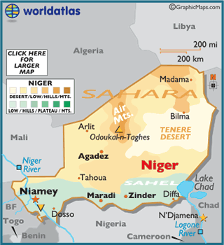
In northern Niger, the Air Mountains punctuate the Sahara desert with a series
of nine massifs. The highest point of the country, Mont Idoukal-n-Taghes at
6,633 ft (2,022 m), is located in the south central region of the Air Mountains.
Climate:
The north region of Niger is mostly desert, and subsequently hot, dry and dusty
conditions are the norm. Rain drops there often evaporate before they even reach
the ground.
In the far south, Niger is more tropical, where rainy days are quite common.
The economy of Niger is overwhelmingly agricultural, with about 90% of the workforce engaged in farming (largely of a subsistence type). The Hausa, Kanuri, and Songhai are mainly sedentary farmers, and the Fulani and Tuareg are principally nomadic and seminomadic pastoralists. The leading crops are cowpeas, cotton, peanuts, millet, sorghum, cassava, and rice. Cattle, sheep, goats, camels, donkeys, horses, and poultry are raised. Niger's agricultural production is subject to climatic changes, and there are recurring food shortages due to inadequate harvests resulting from too little rain.
Most of the country's few industries produce basic consumer goods such as processed food and beverages, soap, and textiles. In addition, chemicals, construction materials, peanut oil, and ginned cotton are produced. Niger has some of the world's largest uranium deposits, and the mining of high-grade uranium ore began in the 1970s at Arlit in the Aïr Massif. Small quantities of cassiterite (tin ore), low-grade iron ore, gypsum, phosphates, coal, natron, and salt also are extracted. Gold and petroleum deposits are being explored. There is a fishing industry in the Niger River and Lake Chad.
Niger has a very limited transportation network; there is no railroad, and most of the country's all-weather roads are confined to the south and southwest. A major road also runs N from Zinder, through Agadez (in the Aïr Massif), and into Algeria. Niger is landlocked and has only poor access to the sea.
The annual cost of Niger's imports usually is considerably higher than the value of its exports. The leading imports are foodstuffs, machinery, vehicles and parts, petroleum, and cereals; the chief exports are uranium ore, livestock products, cowpeas, onions, and cotton. The principal trade partners are France, the United States, and Nigeria
Niger is governed under the constitution of 2010. The executive branch is headed by a president, who is popularly elected for a five-year term and may be reelected to a second term. The prime minister is appointed by the president. The unicameral National Assembly has 113 members who are popularly elected for five-year terms. Administratively, the country is divided into eight regions, including the capital district.
Niger is extremely arid except along the Niger River in the southwest and near the border with Nigeria in the south, where there are strips of savanna. Most of the rest of the country is either semidesert (part of the Sahel) or part of the Sahara. In N central Niger is the Aïr Massif (average elevation: 3,000 ft/910 m; maximum elevation: c.5,900 ft/1,800 m), which receives slightly more rainfall than the surrounding desert. In addition to Niamey, other cities include Maradi, Tahoua, and Zinder.
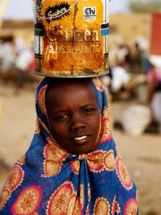
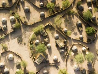
The main ethnic groups are the Hausa, the Songhai and Djerma (Zarma), the Fulani, the Tuareg, and the Kanuri. The great majority of the population is rural and lives in the south. There is a significant migration of seasonal labor to Ghana, Nigeria, and Chad. About 80% of the population is Muslim; most of the rest adhere to traditional religious beliefs, except for a small Christian minority in the cities. The country's official language is French; Hausa, Djerma, and other indigenous languages as well as Arabic are also spoken.