.gif)
.gif)


Tel Code..: +243
Ethopian Airlines - KLM- Lufthansa
Viza..: Needs
Courses or boosters usually advised: Hepatitis A; Poliomyelitis; Tetanus; Typhoid; Yellow Fever.
Other vaccines to consider: Cholera; Diphtheria; Hepatitis B; Meningococcal Meningitis; Rabies.
Yellow fever vaccination certificate required for travellers over 1 year of age arriving from countries with risk of yellow fever transmission.
Name: Democratic Republic of CONGO
President: Joseph Kabila (2001)
Prime Minister: Augustin Matata Ponyo Mapon (2012)
Land area: 875,520 sq mi (2,267,599 sq km); total area: 905,568 sq mi (2,345,410 sq km)
Population (2012 est.): 73,599,190 (growth rate: 2.58%); birth rate: 37.05/1000; infant mortality rate: 76.63/1000; life expectancy: 55.74; density per sq km: 30
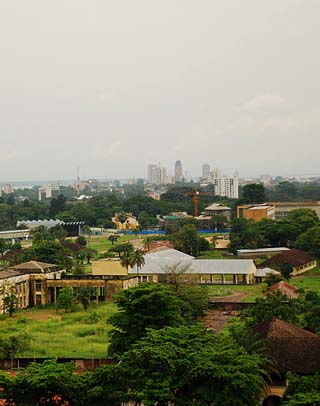
Capital and largest city (2009 est.): Kinshasa, 8,401,000
Other large cities: Lubumbashi, 1,543,000; Mbuji-Mayi, 1,488,000; Kananga 878,000; Kisangani 812,000
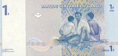
Monetary unit: Congolese franc
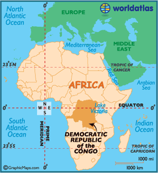
Dissected by the Equator,
the Democratic Republic of the Congo (DRC), formerly called Zaire, is the third
largest country on the African continent.
 The country is
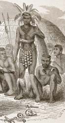
still the ancestral homeland for over 200 ethnic groups, most descended from
kingdoms established long before the Europeans arrived
in the late 1800s.
The Kingdom of Luba became the most vital commercial center for the trade of
ivory and other goods, and by the 16th century had emerged with a strong
government. Long distance trade ultimately aided in the downfall of Luba, and in
1899 the empire was split in two before being completely absorbed into the
Belgian Congo Free State.
Commissioned by King Leopold II of Belgium,
Henry Stanley was the first European to
explore the Congo Basin area.
Upon hearing Stanley's report regarding the indigenous natural attributes of the
land, King Leopold subsequently took control, imposing a system of forced labor
that was the catalyst for the first human rights movement in the 20th century.
Subsequently, he was forced to grant colonial status to the then Belgium Congo
in 1908.
After gaining complete independence from Belgium in
1960, a non-stop parade of assassinations, civil wars, coups, corrupt dictators,
brutal murders, rebellions and needless bloodshed plagued the land.
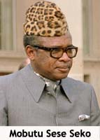 In 1971, the country
was renamed to the Republic of Zaire by President Mobutu Sese Seko. Under
Mobutu's command, despite an achievement of both peace and stability, the
government was responsible for severe human rights violations and a cult of
personality and corruption. It was not uncommon to see citizens walk the streets
wearing clothing with his likeness emblazoned on them.
Opponents began demanding for a reform in 1990, with tensions flaring by 1996 as
the Rwandan Civil
War and genocide poured into Zaire.
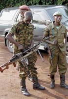
A small group of Tutsi militia invaded the country with ambitions to overthrow
Mobutu, and were joined by select Zairean politicians seeing an opportunity to
finally out the president.
Mobutu fled Zaire in May 1997, and revolutionary leader Laurent-Désiré Kabila
named himself president in the aftermath. Zaire was reverted back to its
original name of the Democratic Republic of the Congo, and Kabila asked all
foreign military forces to return to their respective countries. This mostly out
of fear of a plotted coup against him to transfer the presidency to a Tutsi.
Rwandan troops
responded negatively to Kabila's request, and launched the Tutsi-led
Rassemblement Congolais pour la Democratie (RCD). To offset Rwandaninfluence
in the DRC, Ugandan troops created the Movement for the Liberation of Congo (MLC),
which was led by warlord, Jean-Pierre Bemba. The clash of both organizations
sparked a second war, further weakening the DRC's already fragile army.
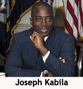 After the
assassination of Kabila in 2001, his son Joseph succeeded office, and a peace
deal was reached between him, the RCD and MLC. By 2003, aside fromRwanda,
all foreign troops exited the DRC and the country began rebuilding itself.
Continued ethnic strife, political instability, and poor management of
infrastructure has greatly impacted the country in a most negative way.
Travelers are warned that journeying to the Congo (DRC) can be quite dangerous.
The economy of this land of vast, natural resources, has declined dramatically
in the past few decades. Reforms are being implemented, but serious recovery is
projected to be many years away.
The
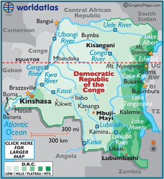
massive expanse of the Congo Rainforest, the second largest rainforest in the
world (after that of the Amazon) covers most of the Congo River basin, central
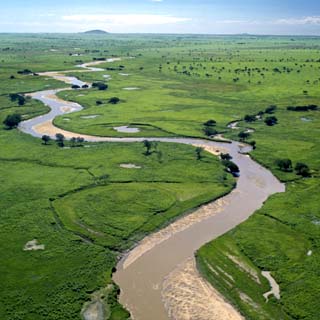
and west. The Congo River itself is 2,733 miles (4,398 km) long, and is
navigable for almost 900 miles (1,448 km).
This area of the DRC is surrounded by plateaus merging into savannas in the
south and southwest, by mountainous terraces in the west, and by dense
grasslands extending beyond the Congo River in the north.
In the east, the land rise into a plateau with heights over 5,000 ft (1,524 m)
and then into the higher glaciated and volcanic mountains of the Great Rift
Valley. Southeast, the land rises into the peaks of the Shaba Plateau.
The highest point of the Democratic Republic of the Congo is Mt. Stanley at
16,765 ft (5,110 m); the lowest point of the country is the Atlantic Ocean (0
m).
A number of lakes front the country's eastern borders, including lakes Albert,
Edward, Kivu, Mweru and Tanganyika.
Climate:
The Democratic Republic of the Congo is hot and humid both central and west.
Daily highs approach 90º (32°C).
In the upper reaches of the eastern and southeastern plateaus and mountains,
conditions moderate dramatically. Countrywide, however, the mean temperature
approaches 76º (24°C).
As a result of its equatorial location, the Congo experiences large amounts of
precipitation and has the highest frequency of thunderstorms in the world.
Heavy rains are common from October through May (south
of the equator),
and from April to November in the northern regions. The annual rainfall can
total upwards of 80 inches (2,000 mm) in some places.
Congo's mineral wealth is the mainstay of the economy, but the development of the mining industry has occurred at the expense of commercial agriculture. The economy's growth spurted under Belgian control in the 1950s, slowed considerably during the country's postindependence troubles in the early 1960s, accelerated again in the late 1960s when political stability returned, and then generally declined beginning in the 1970s, when the nationalization of major industries resulted in a reduction of private investment. For a decade beginning in the early 1990s much of the economy was in a state of collapse, but with the end of most of civil warfare that devastated Congo, economic stability improved in the early 2000s and foreign investment is again occurring.
Although only 3% of the nation's land area is arable, a substantial part of the labor force is engaged as subsistence farmers. The principal food crops are cassava, bananas, root crops, corn, and fruits. Coffee, sugarcane, palm oil, rubber, tea, quinine, and cotton are produced commercially, primarily for export. Although agricultural production satisfied domestic demands before independence, Congo has become dependent on food imports. Goats, sheep, and cattle are raised.
Mining is centered in Katanga province; products include copper, cobalt, zinc, manganese, uranium, cassiterite (tin ore), coal, gold, and silver. Diamonds are mined in Kasai. There are major deposits of petroleum offshore near the mouth of the Congo River. About 75% of Congo is covered with forest containing ebony and teak as well as less valuable woods.
Kinshasa and Lubumbashi are the country's most important industrial centers. Industries produce processed copper, zinc, and cassiterite; refined petroleum; processed foods and beverages; and basic consumer goods such as clothing and footwear. The numerous rivers of Congo give it an immense potential for producing hydroelectricity, a small but significant percentage of which has been realized. The chief hydroelectric facilities are situated in Katanga and produce power for the mining industry; another major project is located at Inga, on the Congo River near Kinshasa.
Rivers form the backbone of the country's transportation network; unnavigable parts of the Congo River (e.g., Kinshasa-Matadi and Kisangani-Ubundi) are bridged by rail lines, but the rail and road network in Congo is both very limited for a nation of it's size and in disrepair as a result of the civil war. Matadi, Boma, and Banana can handle oceangoing vessels. E Congo is linked (via Lake Tanganyika) by rail with the seaport of Dar-es-Salaam, Tanzania.
The country's export earnings come almost entirely from sales of primary products, which are vulnerable to sharp changes in world prices. Since 1994 diamonds have become the country's leading export as a result of a decline in the production of copper (once the leading mineral product in terms of value). Petroleum also accounts for a substantial portion of export earnings. Other important exports are coffee, cobalt, palm products, and rubber. The leading imports are foodstuffs, machinery, transport equipment, fuels, and consumer goods. The country's principal trade partners are Belgium, the United States, South Africa, and France.
The Democratic Republic of the Congo is governed under the constitution of 2006 as amended. The president, who is the head of state, is popularly elected and may serve two five-year terms. There is a bicameral legislature. The National Assembly has 500 members, who serve five-year terms; the majority (439) of the members are elected proportionally, the rest directly. The prime minister is chosen from the party or coalition that controls the assembly. The Senate has 108 indirectly elected members, who also serve for five years. Administratively, the country is divided into ten provinces (Bandundu, Bas-Congo, Équateur, Kasai-Occidental, Kasai-Oriental, Katanga, Maniema, Nord-Kivu, Orientale, and Sud-Kivu) and the federal district (which includes Kinshasa). Each province also has an elected assembly.
Congo lies astride the equator, and virtually all of the country is part of the vast Congo River drainage basin. North central Congo is made up of a large plateau (average elevation: c.1,000 ft/300 m), which is covered with equatorial forest and has numerous swamps. The plateau is bordered on the east by mountains, which rise to the lofty Ruwenzori range (located on the border with Uganda). The Ruwenzori include Margherita Peak (16,763 ft/5,109 m), the country's highest point; they are situated in the western or Albertine branch of the Great Rift Valley, which runs along the entire eastern border of the country and also takes in lakes Albert, Edward, Kivu, and Tanganyika. In S Congo are highland plateaus (average elevation: c.3,000 ft/910 m; highest elevation: c.6,800 ft/2,070 m), which are covered with savanna. The high Mitumba Mts. in the southeast include Lake Mweru (situated on the border with Zambia). In addition to Kinshasa, the major urban areas include Boma, Bukavu, Kalemie, Kamina, Kananga, Kisangani, Kolwezi, Likasi, Lubumbashi, Matadi, Mbandaka, and Mbuji-Mayi.
The population of Congo comprises approximately 200 ethnic groups, the great majority of whom speak one of the Bantu languages. In addition, there are Nilotic speakers in the north near South Sudan and scattered groups of Pygmies (especially in the Ituri Forest in the northeast). The principal Bantu-speaking ethnic groups are the Kongo, Mongo, Luba, Bwaka, Kwango, Lulua, Lunda, and Kasai. The Alur are the main Nilotic speakers. In the 1990s, Congo also had an influx of immigrants, particularly refugees from neighboring countries. In 1985 over half the population was rural, but the country is becoming increasingly urbanized.
French is Congo's official language, but it is spoken by relatively few persons. Swahili is widely used in the east, and Lingala is spoken in the west; Tshilaba is also common. About 50% of the inhabitants are Roman Catholics and 20% are Protestants. A substantial number are adherents of Kimbanguism, an indigenous Christian church. Many also follow traditional religious beliefs, and about 10% are Muslims.